Burial Plot Map – Why is it Important?

Burial plot map is a vital tool for cemetery caretakers.  Many cemetery management offices often have cemetery plot maps in their offices for their employees and visitors to use.  However, these maps are usually inexact and allow for too much variation to have a truly accurate understanding of the land available for future plots as they were developed without incorporating data from ground penetrating radar services

burial plot map before and after
Burial plot map before and after.

A burial plot map is designed to allow visitors to break down the various areas of a cemetery to determine the location of a specific grave. Knowing the general location of a grave is helpful, but it still leaves you wandering around looking for your loved one’s specific gravesite.

With an accurate cemetery burial plot map, patrons are able to know the exact location of the grave they are searching for with little to no hassle. Each grave is noted by a polygon over the plot where it is located. This allows for a quick and simple search to find the correct area.

From paying respects to compiling genealogical research, cemetery burial plot maps provide an uncomplicated and easily understood diagram to help you meet your goals. Just a quick review of the map and you are already on your way.

Planning for the future of your cemetery

As most commercial memorial gardens have a finite area of real estate to work within, it is imperative to have a highly accurate cemetery burial plot map. This allows management to have a clear understanding of the space that is used versus the space that is still available.

Scaling up your cemetery’s operation can be quite difficult.  Without an accurate understanding of a graveyard’s layout, there is significant possibility of lost revenue due to wasted space.  Extremely accurate burial plot maps give you peace of mind knowing that every inch of property is considered and accounted for.

Particular care should be taken with burial plot maps to ensure nothing is lost to history. Unfortunately, due to inaccurate or lost cemetery records, many graveyards no longer have access to detailed information regarding the exact layout of their burial plots.

When creating a cemetery plot map it is of the utmost importance to have an accurate understanding of the exact placement of each grave. These plot maps are deliberately designed to break down the overall cemetery layout into more easily digestible information.

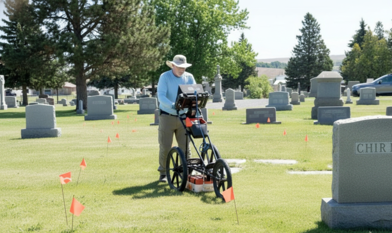
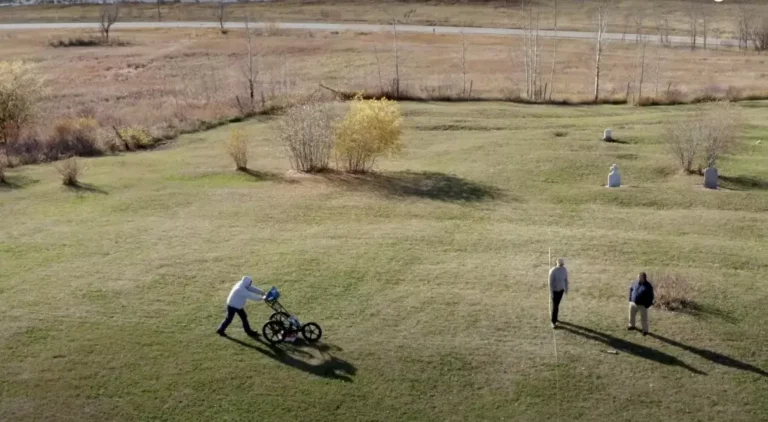
Cemetery mapping services providers who also have expertise in ground penetrating radar service can generate even more detailed mapping information that will show individual graves within a lot.  By incorporating data from ground penetrating radar services, the burial plot maps show the location of unmarked graves.

Cemetery mapping GPR can be a valuable tool when it is used in as part of a cemetery mapping service portfolio. Unlike other geophysical testing methods, cemetery mapping GPR is unique in its ability to detect some small objects, such as buried grave markers. GPR can also distinguish the depth of these objects with amazing accuracy.

Electrical conductivity plays a large role in the effectiveness of how cemetery mapping GPR works for a given area. Ground penetrating radar anomalies do not display as clearly in clay rich or wet soils. Additionally; interpreting the cemetery mapping GPR data is not easily done without specialized training, and considerable technical planning is needed during extensive field surveys.

Why GIS cemetery mapping is the best investment

Too often, because of the historic nature of cemeteries, knowledge of burals and marker conservation is documented in paper forms and the experiences of individual caretakers  Taking these historic texts and maps and combining them with GPS surveys and digital photography into a GIS cemetery mapping platform allows for better management and long-term planning.

The capability for both staff and visitors to find the location of, and information about, existing burials is probably the most important priority when discussing the development of a GIS cemetery mapping application. As with any project assessing the needs of the client during project planning is important.

GIS cemetery mapping services empowers cemeteries to offer their visitors a way to find their loved one’s exact burial location quickly.  The interactive burial plot map can be readily shared online with the public, researchers, and other stakeholders.  Additionally, cemetery management, planning, and future development become infinitely simplified. 

A GIS cemetery mapping services provider will create an accurate rendering of the cemetery’s burial plots. This easily updatable system visualizes each individual grave carefully framed out. The interactive digital burial plot map will contain information such as the decedent’s name, birth & death dates, and any military association if applicable.

These cemetery plot maps will also include burials that may not be present in your current cemetery records that were discovered through a ground pentrating radar service. These plots will be indicated with a note stating there is a high likelihood of an unmarked burial. This helps by ensuring it will not be mistakenly disturbed or double sold.

Cemetery GIS mapping platforms are used to study historical burial grounds and allow scientists to learn more about the population interred there. Many military cemeteries have implemented GIS cemetery mapping applications and are now able to forecast the number of veterans that will need to be provided for each year. This is done by using historical demographic and GIS data to make a prediction of potential current demands.

Archaeologists and historians have been using these GIS cemetery mapping platforms to study ancient burial grounds and cemeteries for years. However, the technology is now becoming more widely available for private sector use and a number of cemetery mapping service providers now offer this solution.

GIS cemetery mapping is the perfect asset management solution for developing, managing, and preserving cemeteries. It is vital to ensure careful record-keeping that will be maintained accurately for decades to come. This industry is plagued with missing, misrecorded, or destroyed records that make it difficult to effectively plan for the future.

Ensuring that cemetery records are properly maintained and updated is vital to protecting our collective heritage. With GIS cemetery mapping, caretakers can guarantee the respectful and efficient operation of their cemeteries.

See examples of our digital burial plot maps HERE.

See an overview of how to develop a burial plot map HERE.