
From the Ritzville Adams County Journal
Digital cemetery mapping by ViaVista Mapping will begin in June starting with collecting field data and finishing with generating digital cemetery maps for the Ritzville Memorial Cemetery.
According to a service agreement with the city, digital cemetery mapping services will include scanning for sub-surface anomalies and unmarked burials using cemetery ground penetrating radar scanning.

Cemetery GPR scanning can also detect disturbed soil caused by wooden or metal caskets, voids in the earth with little to no surviving skeletal remains, ceremonial burial objects, vaults, improperly positioned or unmarked graves, and underground utilities.
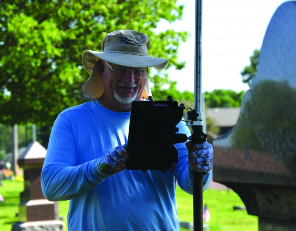
Scott Field, a ViaVista technician who remotely attended the City Council’s May 7 meeting, said the onsite process will begin the first week of June.
Field will use the radar to identify unmarked burial locations and anomalies and use dissolvable paint to mark each anomalous site. He will also place a flag at the approximate center of each identified location.
When the initial process for the entire 10.8 acre cemetery is complete, Field will return with satellite GPS to record exact coordinates for every flagged location and sites that already have a headstone or other marker.
Field said it could take up to 90 days to develop a digital map publicly accessible via a website. In addition, the company will provide printable map files suitable for large-scale architectural prints.
After completion, the digital cemetery map will be searchable and shareable online. In addition, the city may post a printed QR code at the cemetery.
“Visitors looking for burial sites will be able to use their phone or other device to scan the code and identify exact locations. No more wandering the cemetery searching for an ancestor or loved one,” he said.
According to the service agreement, digital cemetery mapping services will cost $52,775, a portion of which will be covered by grant from the Washington State Department of Archaeology and Historic Preservation. The city’s coronavirus recovery funds should cover the remainder.
The mapping agreement was approved April 16 by the City Council, which took up the subject during a September 2023 meeting.
“Several people want to see the cemetery kiosk updated,” Councilwoman Michelle Plumb said during a September meeting. “We need to know where everything’s located to make an accurate map.”
From the Ritzville Adams County Journal