
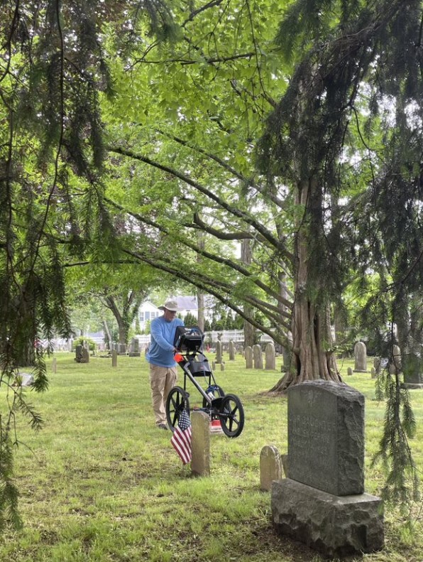
Accurate cemetery mapping is essential for preserving history, honoring the deceased, and enabling smooth cemetery operations. But many cemeteries—especially those established decades or centuries ago—face a wide range of challenges that make mapping a complex endeavor. Fortunately, technologies like Ground Penetrating Radar (GPR) are revolutionizing the way we understand and document burial spaces.
At ViaVista Mapping, we specialize in solving these tough problems using GPR and GPS-enabled digital mapping platforms. Here are some of the most common cemetery mapping challenges—and how GPR can address them.
1. Unmarked Graves and Incomplete Records
One of the biggest obstacles in cemetery mapping is the presence of unmarked or undocumented graves. Over time, headstones may deteriorate, shift, or disappear entirely, and paper records may be lost or contain errors.
How GPR Helps:
GPR allows us to detect underground anomalies—like burial shafts or vaults—without disturbing the site. This non-invasive technology identifies both marked and unmarked graves, helping cemetery operators create accurate, up-to-date maps even when historical records are incomplete.
2. Burial Plot Misalignment
In older cemeteries, it’s not uncommon for burial plots to be misaligned with headstones or to differ from recorded layouts. This can lead to uncertainty during new interments and planning efforts.
How GPR Helps:
By visualizing subsurface features, GPR reveals the actual location of burials, helping reconcile surface markers with reality. The data is then incorporated into a modern digital cemetery map, ensuring the layout is correct moving forward.
3. Overlapping or Double Interments
Some cemeteries—especially family plots or those in rural communities—may contain overlapping or double interments that are undocumented or forgotten.
How GPR Helps:
GPR can identify multiple burial layers in a single location. This is particularly helpful in resolving disputes, protecting sacred space, and preventing accidental disturbance of remains.
4. Preservation of Historic Cemeteries
Historic cemeteries are valuable cultural assets, but mapping them comes with its own set of challenges, including fragile monuments, erosion, and missing documentation.
How GPR Helps:
As a non-destructive method, GPR is ideal for historic cemetery mapping. It enables us to locate graves without excavation and to document burial patterns that are part of a site’s historical significance. The resulting maps support preservation, interpretation, and grant funding opportunities.
5. Inefficient Operations and Limited Access to Data
Cemeteries operating without modern mapping tools often struggle with plot availability, record retrieval, and day-to-day management.
How GPR Helps:
GPR is part of a complete mapping workflow that includes GPS data collection and GIS-based visualization. The final deliverables include digital maps that can be accessed from computers or mobile devices, enabling cemetery staff to easily search records, identify available plots, and plan future use with confidence.
The Future of Cemetery Mapping is Grounded in Technology
From small rural graveyards to large municipal cemeteries, every site has its own set of challenges. But with modern cemetery mapping solutions like GPR and geospatial tools, these problems can be solved accurately, respectfully, and permanently.
At ViaVista Mapping, we combine expert fieldwork, precise GPS/GIS integration, and powerful subsurface imaging to help communities honor their past while planning for the future.
Looking to solve cemetery mapping challenges at your site?
Contact us today to learn how our GPR-based services can bring clarity and confidence to your cemetery.
See examples of our digital cemetery mapping HERE.
Visit the Yoakum City Colored Cemetery map to see how we helped them preserve their heritage.