
The Evolution of the Modern Cemetery Map
Cemetery mapping has come a long way from earlier computer-printed maps cobbled together from digitized ledgers and manual data entry. Today, GPS, GIS, and Ground Penetrating Radar work together to produce a modern cemetery map accurate to the centimeter. Here, we trace that evolution, break down how each technology contributes, and explain why precision mapping […]
How GPR is the Future of Cemetery Design and Planning
Modern cemetery design and planning require accurate information about what lies beneath the surface. Ground penetrating radar, or GPR, is a way for cemetery managers to identify available burial space, locate unmarked graves, and detect subsurface hazards before making decisions about expansion, maintenance, or infrastructure improvements. GPR Cemetery Planning Prevents Costly Mistakes Planning cemetery expansions […]
Using Ground Penetrating Radar to Find Graves
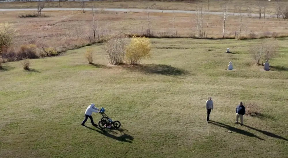
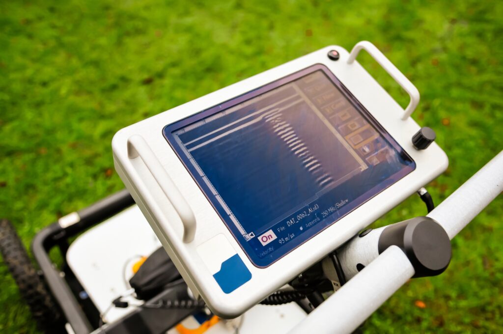
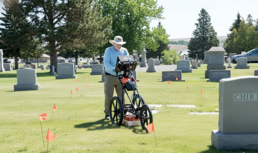
Ground Penetrating Radar (GPR) has become critical for locating unmarked graves and preserving the integrity of burial sites. This non-invasive technology allows cemetery managers, historians, and communities to rediscover forgotten plots, verify burial locations, and protect sacred ground from unintentional disturbance. At ViaVista, we use ground penetrating radar to find unmarked graves and subsurface anomalies […]
Modern Cemetery Mapping and Information Systems Explained

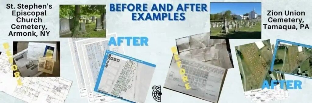
Cemeteries may still rely on handwritten ledgers, weathered notebooks, or sketches that have passed through decades of caretakers. These records tell a story, but they often leave gaps. Graves may be misplaced, markers lost, or names duplicated. Modern cemetery mapping and information systems close those gaps by combining tools that record what’s visible on the […]
Cemetery Plot Maps: A Comprehensive Guide
Step into the world of cemetery plot maps and unlock the secrets hidden within the graves. In this comprehensive guide, we will take you on a journey through the intricate web of pathways, rows, and names that make up a cemetery or burial plot map. Whether you’re a cemetery caretaker, genealogy enthusiast, a history buff, […]
The Role of Ground-Penetrating Radar (GPR) in Modern Cemetery Mapping

Cemeteries are more than final resting places—they are living records of a community’s history, heritage, and loved ones. But over time, paper records fade, headstones deteriorate, and undocumented burials leave gaps in the story. This is where modern technology, especially ground-penetrating radar (GPR), plays a vital role in cemetery mapping. In this post, we’ll explain […]
Top 5 Reasons to Map Your Cemetery Before the End of the Year

There are at least 5 reasons to map your cemetery before the end of the year. As the calendar winds toward year-end, now is the ideal time to prioritize your cemetery mapping project. Whether you’re responsible for a historic burial ground or a growing municipal cemetery, accurate mapping is essential for effective management, compliance, and […]
Fix Cemetery Mapping Challenges with GPR
Accurate cemetery mapping is essential for preserving history, honoring the deceased, and enabling smooth cemetery operations. But many cemeteries—especially those established decades or centuries ago—face a wide range of challenges that make mapping a complex endeavor. Fortunately, technologies like Ground Penetrating Radar (GPR) are revolutionizing the way we understand and document burial spaces. At ViaVista […]
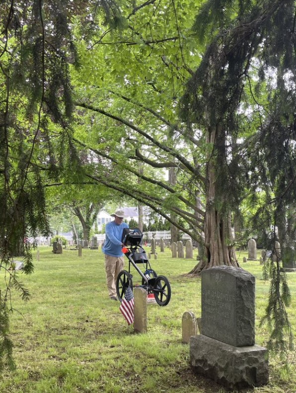
How GPR for Cemeteries Honors Veterans

Honoring Veterans Through Improved Mapping and Record Access As Memorial Day draws near, we take time to reflect on the immense sacrifices made by the brave men and women who served our country. Their stories live on in the memories of their loved ones—and in the quiet corners of cemeteries across the nation. At ViaVista […]
Why Drone Cemetery Mapping is Not the Answer
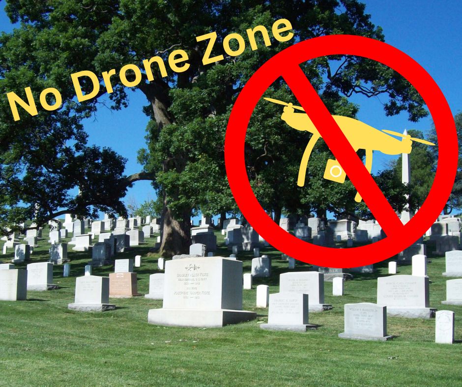
Cemetery mapping with GPR and GPS is the wisest investment Cemetery management requires accurate mapping to locate graves, plan expansions, and maintain burial records. While drone cemetery mapping is becoming popular, it has significant limitations. The combination of ground-penetrating radar (GPR) and on-site GPS data collection offers a more precise and reliable solution. Here’s why […]