
GIS Cemetery Mapping - Featured Maps
Web-based, dynamic, searchable cemetery maps
Our GIS cemetery mapping process provides our clients with a custom, interactive burial plot map of the cemetery on the Esri ArcGIS platform using GPS and photographic data collected onsite.
What is GIS Cemetery Mapping?
GIS cemetery mapping uses Geographic Information Systems technology to create dynamic, searchable digital maps of cemeteries. Ultimately, it supplies cemetery managers with a powerful tool to locate and visualize burial plots so they may replace outdated manual and paper-based maps with a more accurate digital alternative.
How GIS Improves Cemetery Data Accuracy
GIS technology improves data accuracy by using precise GPS surveying and data collection to eliminate errors common in traditional recordkeeping, like misplaced or missing grave locations, illegible or outdated paper records, and inconsistent plot numbering.
How Our GIS Mapping Process Works
Through our GIS mapping process, each burial plot and GIS grave location is linked to exact spatial coordinates using onsite GPS surveying combined with legible gravestone inscriptions and veteran status. This data is then integrated into a user-friendly Esri ArcGIS interface, so cemetery managers have access to an interactive and visually appealing GIS survey map.
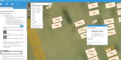
Our cemetery burial plot map features robust search capabilities, allowing users to find graves by name, veteran status, or other attributes. Cartographic design principles are applied to ensure the map is both informative and easy to interpret, improving cemetery data accuracy and streamlining cemetery operations.
Key deliverables:
- The finished burial plot map is made available to the client via URL/online access and will be accessible from any device with internet access.
- Print capability will be enabled to facilitate PDF/paper printouts of the cemetery map on demand at various scale settings.
- We provide our clients with a URL to share the cemetery map with stakeholders and the public through their website, social media, newsletters, and even with a QR code posted at the cemetery.
- Additionally, a large-format, printable, architectural-size burial plot map will be created and delivered via PDF files.
Click on the images below to explore examples of our GIS cemetery mapping
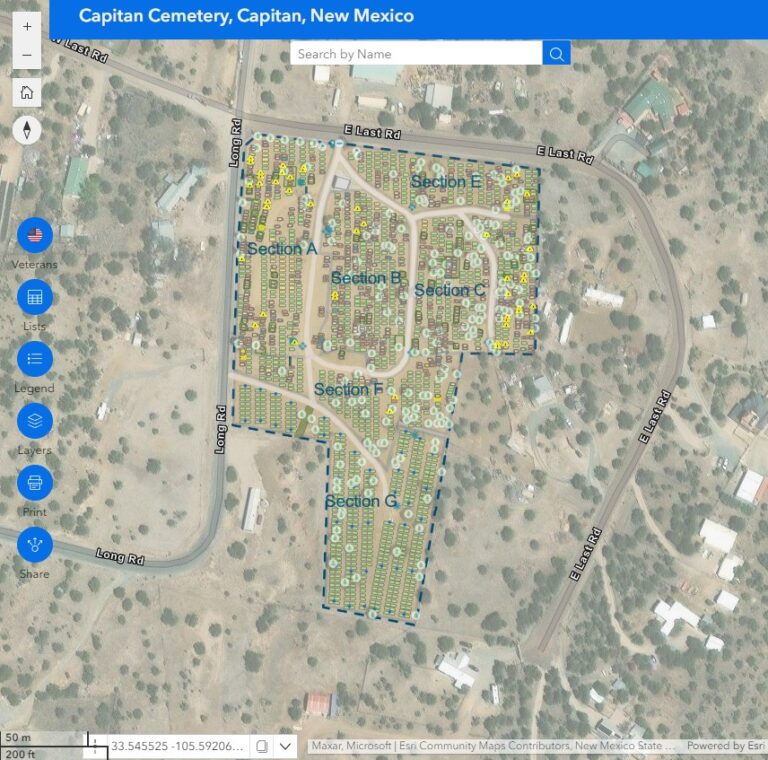
Village of Capitan Cemetery, Capitan, NM
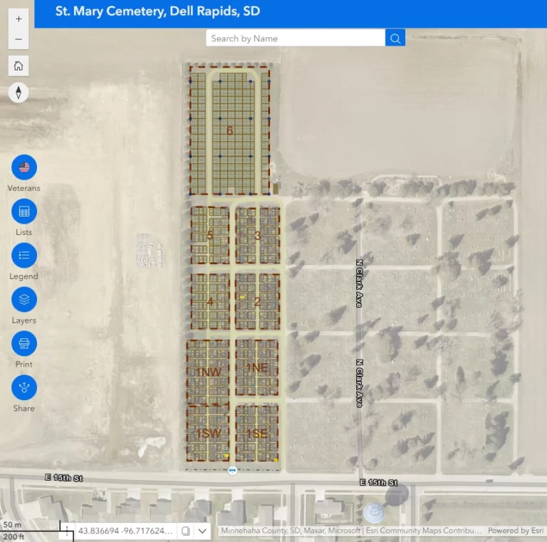
St. Mary Cemetery, Dell Rapids, SD
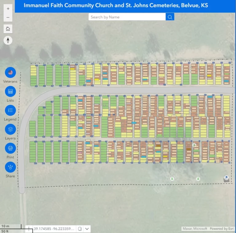
Immanuel Faith Community Church and St. Johns Cemeteries, Belvue, KS
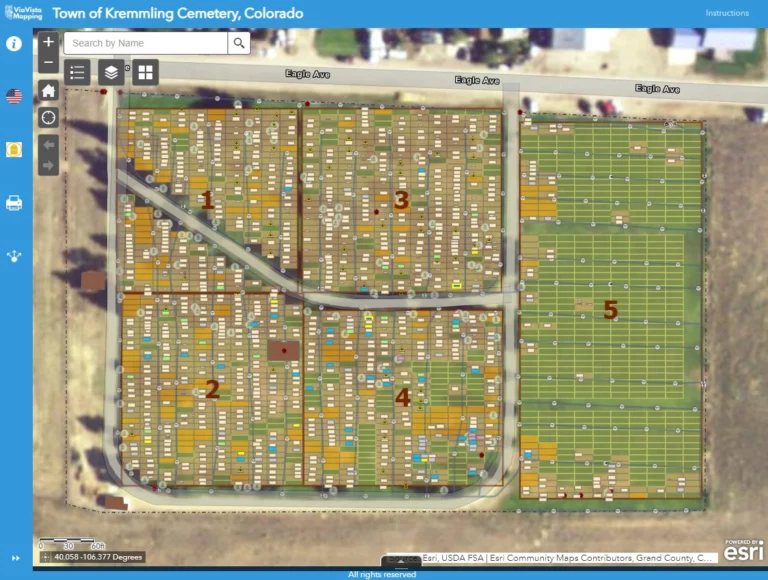
Town of Kremmling Cemetery, Kremmling, CO
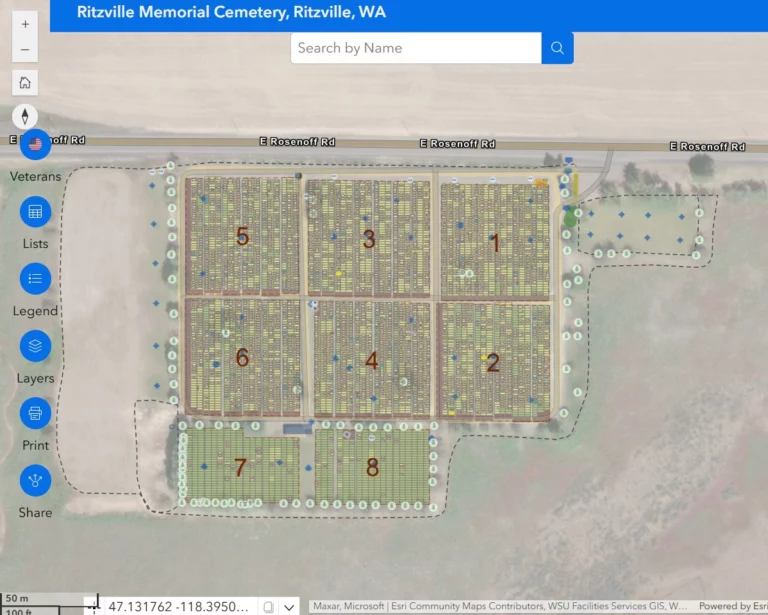
Ritzville Memorial Cemetery, Ritzville, WA
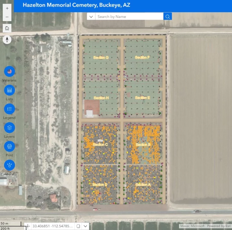
Hazelton Memorial Cemetery in Buckeye, AZ
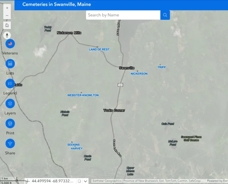
Cemeteries located in Swanville, ME
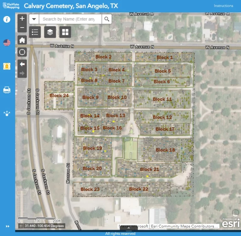
Calvary Cemetery in San Angel, TX
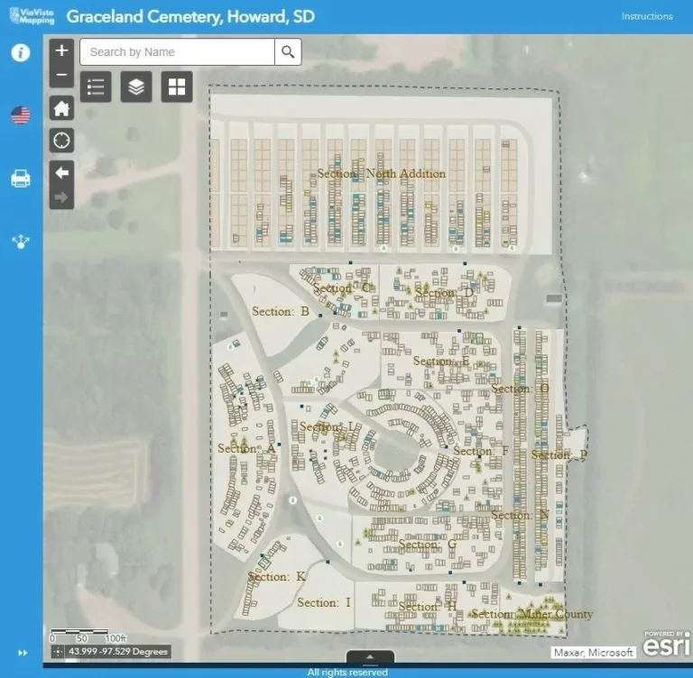
Graceland Cemetery in Howard, SD