
Using Ground Penetrating Radar to Find Graves
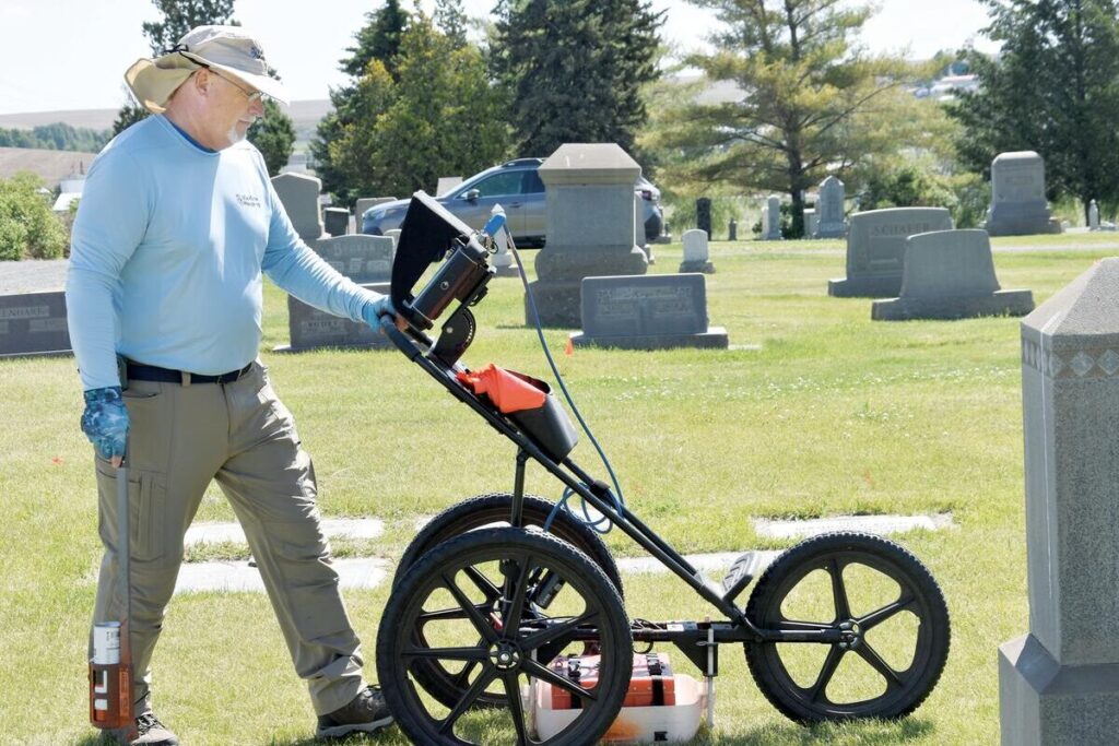
Ground Penetrating Radar (GPR) has become critical for locating unmarked graves and preserving the integrity of burial sites. This non-invasive technology allows cemetery managers, historians, and communities to rediscover forgotten plots, verify burial locations, and protect sacred ground from unintentional disturbance. At ViaVista, we use ground penetrating radar to find unmarked graves and subsurface anomalies […]
Fix Cemetery Mapping Challenges with GPR
Accurate cemetery mapping is essential for preserving history, honoring the deceased, and enabling smooth cemetery operations. But many cemeteries—especially those established decades or centuries ago—face a wide range of challenges that make mapping a complex endeavor. Fortunately, technologies like Ground Penetrating Radar (GPR) are revolutionizing the way we understand and document burial spaces. At ViaVista […]
How GPR for Cemeteries Honors Veterans

Honoring Veterans Through Improved Mapping and Record Access As Memorial Day draws near, we take time to reflect on the immense sacrifices made by the brave men and women who served our country. Their stories live on in the memories of their loved ones—and in the quiet corners of cemeteries across the nation. At ViaVista […]
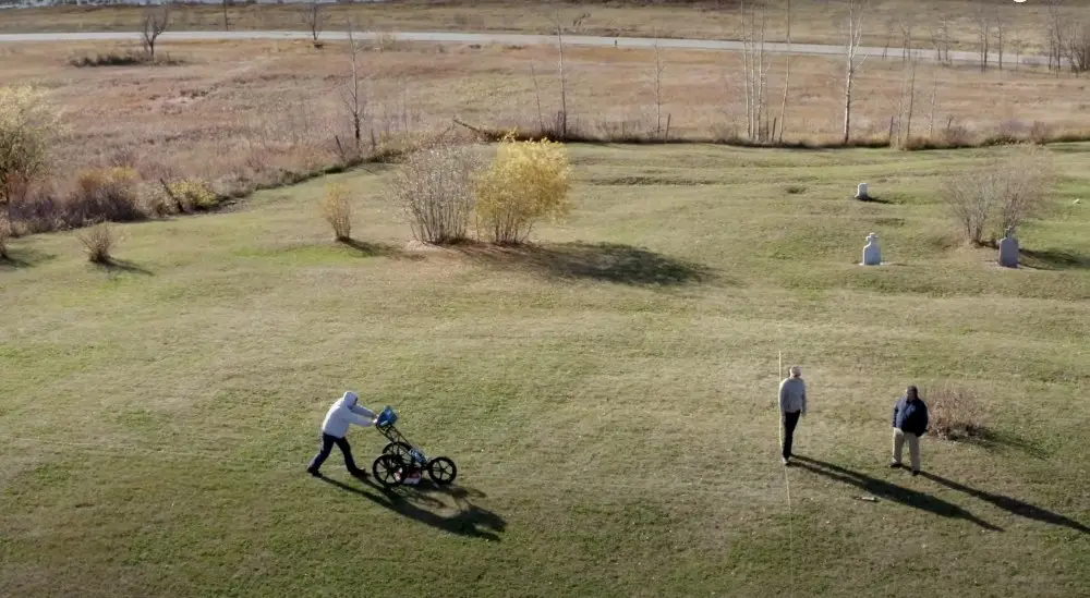
Why Drone Cemetery Mapping is Not the Answer
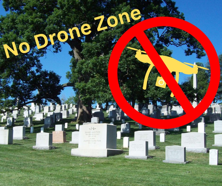
Cemetery mapping with GPR and GPS is the wisest investment Cemetery management requires accurate mapping to locate graves, plan expansions, and maintain burial records. While drone cemetery mapping is becoming popular, it has significant limitations. The combination of ground-penetrating radar (GPR) and on-site GPS data collection offers a more precise and reliable solution. Here’s why […]
Cemetery Mapping Improves Operations
Enhancing Cemetery Operations and Sales with Digital Burial Plot Maps In an industry where history, tradition, and precision matter, digital mapping of cemeteries is transforming the way cemeteries manage their operations and improve sales. By leveraging cutting-edge technologies such as ground-penetrating radar for cemeteries (GPR cemetery mapping) and web-based GIS platforms, cemeteries can enhance record-keeping, […]
Is Cemetery Ground Penetrating Radar Accurate?
Cemetery ground-penetrating radar, or GPR, is a surveying technique that uses electromagnetic waves to detect and map the subsurface. It has been used for decades – but how accurate are these scans? The Accuracy of Ground Penetrating Radar (GPR) Technology Ground-Penetrating Radar is a highly accurate tool. Ground-penetrating radar can be impacted by external factors, […]
Cemetery GPR Scanning to Map the Future of Your Cemetery
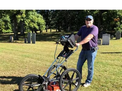
How You Can Use Cemetery GPR Scanning For Future Planning Cemetery GPR Scanning can help you visualize how your cemetery will grow and change over time. GPR (ground penetrating radar) is a great tool for cemetery mapping. GPR can be used to map out existing gravesites, identify potential problems, and plan for the future of […]
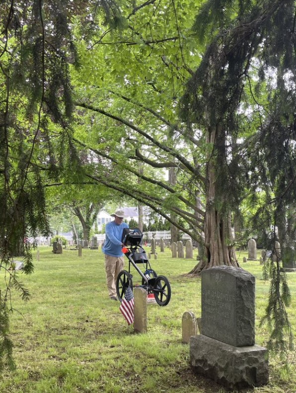
Cemetery burial plot map underway in Ritzville
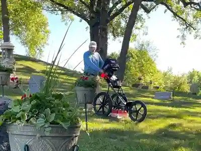
Burial plot map: In early-June, Scott Field of ViaVista Mapping began collecting field data and generating maps at the Ritzville Memorial Cemetery, a half-mile west of town on Rosenoff Road. Founded concurrent with the town in 1887, the cemetery added “Memorial” to its name after the Great Depression in honor of American veterans. As of Monday morning, […]
Exploring Ground Penetrating Radar (GPR) for Cemeteries
Introduction Ground Penetrating Radar (GPR) for cemeteries is a non-invasive technology widely used in various fields, including archaeology, geology, and civil engineering. Its application in cemeteries is particularly significant due to its ability to locate unmarked graves, map burial sites, and assist in cemetery management without disturbing the ground. This blog post delves into the […]
Finding Unmarked Burials
Ground penetrating radar for cemeteries Cemeteries are home to a lot of history, with many US cemeteries having been around for hundreds of years. The passage of time affects each cemetery differently. Thanks to meticulous record-keeping and oversight, some historic cemeteries have pristine records. These cemeteries are, unfortunately, the exception and not the rule. The […]