
Top 5 Reasons to Map Your Cemetery Before the End of the Year

There are at least 5 reasons to map your cemetery before the end of the year. As the calendar winds toward year-end, now is the ideal time to prioritize your cemetery mapping project. Whether you’re responsible for a historic burial ground or a growing municipal cemetery, accurate mapping is essential for effective management, compliance, and […]
Why Drone Cemetery Mapping is Not the Answer

Cemetery mapping with GPR and GPS is the wisest investment Cemetery management requires accurate mapping to locate graves, plan expansions, and maintain burial records. While drone cemetery mapping is becoming popular, it has significant limitations. The combination of ground-penetrating radar (GPR) and on-site GPS data collection offers a more precise and reliable solution. Here’s why […]
Cemetery Mapping Improves Operations

Enhancing Cemetery Operations and Sales with Digital Burial Plot Maps In an industry where history, tradition, and precision matter, digital mapping of cemeteries is transforming the way cemeteries manage their operations and improve sales. By leveraging cutting-edge technologies such as ground-penetrating radar for cemeteries (GPR cemetery mapping) and web-based GIS platforms, cemeteries can enhance record-keeping, […]
How to Create a Burial Plot Map
Create a Cemetery Plot Map With These Tips! A burial plot map is a must for managing a cemetery effectively. If you are responsible for managing a cemetery, then you know that mapping out the plots can be a daunting task. With so many graves to account for, it is important to use the best […]
Why You Should Convert to Digital Cemetery Mapping

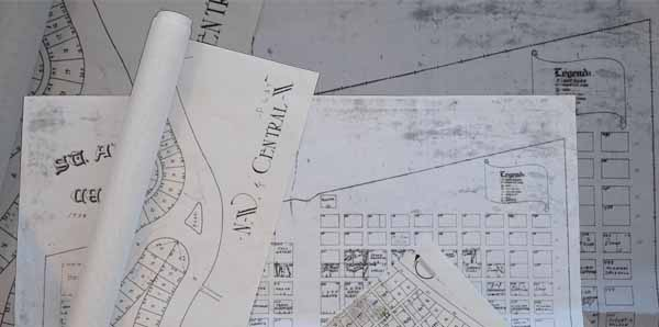
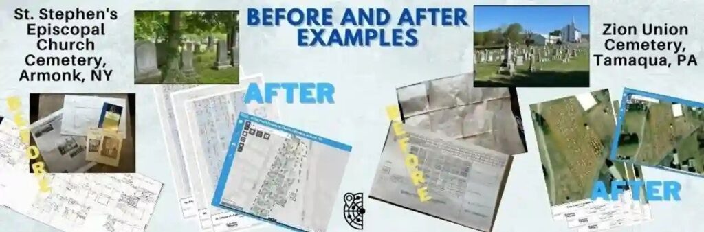
For hundreds of years, cemeteries relied on paper records to keep track of purchased lots and burial locations. But these fragile paper records can become lost or damaged, especially as they age. Digital cemetery mapping preserves this crucial information in a convenient format that can simplify a cemetery’s internal process and help prevent errors. ViaVista […]
Burial Plot Map: Essential Documentation for Every Cemetery
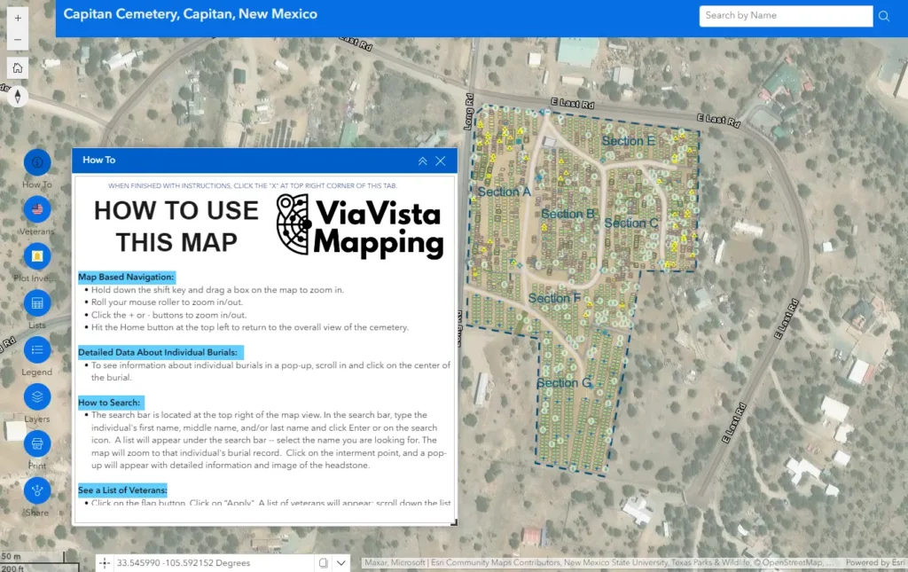
A burial plot map is an integral part of any cemetery or crematorium. It should provide an accurate location of every grave or cremated remains plot within the grounds and the spaces available. Maintaining an accurate cemetery map is essential for day-to-day operations. Furthermore, it helps ensure that only available plots are sold and it […]
Digital Cemetery Mapping in Ritzville, WA
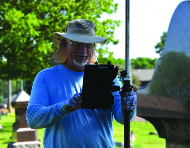
From the Ritzville Adams County Journal Digital cemetery mapping by ViaVista Mapping will begin in June starting with collecting field data and finishing with generating digital cemetery maps for the Ritzville Memorial Cemetery. According to a service agreement with the city, digital cemetery mapping services will include scanning for sub-surface anomalies and unmarked burials using cemetery ground […]
Digital Cemetery Mapping is Reshaping Cemetery Management

Digital cemetery mapping has reshaped the cemetery and death care services. In recent years, cemetery tourism or Tombstone Tourism, has seen a boom. The growing interest in genealogy has encouraged people to hunt out cemeteries in search of their ancestors. Finding ancestors’ burials is part of unearthing their family tree and stories. The fascination with […]
Burial Plot Map – Why is it Important?
Burial plot map is a vital tool for cemetery caretakers. Many cemetery management offices often have cemetery plot maps in their offices for their employees and visitors to use. However, these maps are usually inexact and allow for too much variation to have a truly accurate understanding of the land available for future plots as […]
Cemetery Mapping Problems
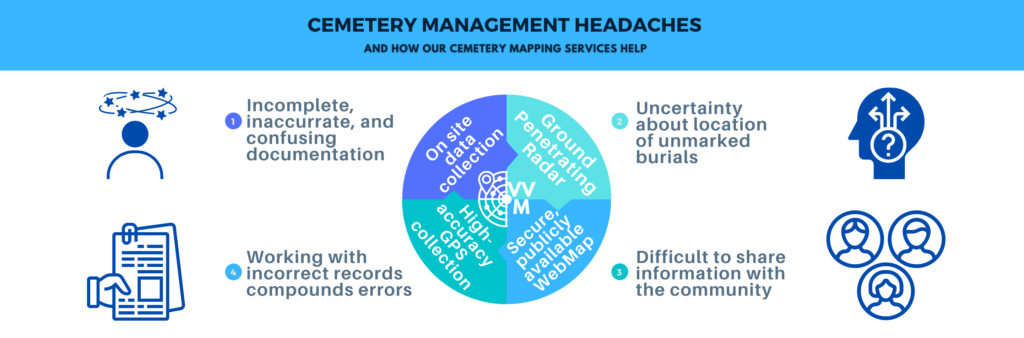
Cemetery Mapping Problems & Solutions Cemetery mapping can help address the most common problems for cemetery managers. Is your cemetery struggling with one of these common mapping issues? We’ve got you covered. Relying on aging paper maps Cemeteries are historic institutions. Their paper maps? Important historical documents. As with any aging documents, cemetery maps must […]