
GIS Cemetery Mapping – How does it help Cemetery Managers?
Technology has become the bedrock of the 21st century. No matter the industry or sector, advancement in technology continues to provide much-needed convenience and ease. Such is the case for cemetery sites. If you are a cemetery manager, operator, or caretaker, it is important for you to stay informed of the latest advancements in technology and how they can be used to improve operations. One such technology is cemetery mapping.
In this article, we will be shedding light on GIS cemetery mapping, what it means, and how it plays its part in helping cemetery sites better manage their operations and increase efficiency. We will explore the various ways this technology can help cemeteries, from digital mapping and record keeping to automated processes and customer service. This discussion will provide an in-depth look at how technology can help cemeteries remain competitive and successful. So without further ado, let’s begin.
What is GIS Cemetery Mapping?
GIS cemetery mapping involves creating a digital representation of a cemetery to provide a detailed overview of the cemetery’s layout and features. It is an important tool for cemetery managers, as it allows them to plan and manage their cemetery operations accurately.
What does GIS Cemetery Mapping Entail?
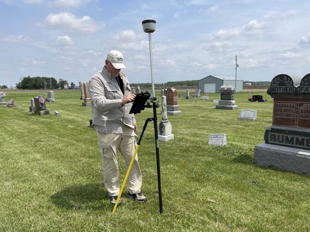
The mapping process begins with a detailed cemetery survey using ground penetrating radar cemetery / GPR cemetery technology to discover unmarked burials and other underground anomalies. GPR cemetery scanning provides critical information needed to generate a comprehensive cemetery mapping result.
After GPR cemetery scanning, the next step is typically conducted using GPS cemetery technology. The location coordinates of all cemetery features are collected with survey-grade GPS data collection equipment, digitized and stored in a GIS (Geographic Information System) and used within a GIS cemetery platform to create a digital cemetery map that provides a comprehensive view of the cemetery, including its layout, features, and other important information.
How Does GIS Cemetery Mapping Help Cemetery Operators, Managers, & Caretakers?
GIS cemetery mapping streamlines a number of processes that traditionally consumed longer time and more effort. Through GIS cemetery mapping, a cemetery manager, caretaker, or operator, can easily process, automate, and provide tailored services to grieving clients. GIS Cemetery mapping can help in the following ways:
Record Keeping
Cemetery mapping allows managers to keep accurate and up-to-date records of the graves and burial sites within the cemetery. This information can be used to track the availability of plots, plan for future expansion, and manage the cemetery’s inventory.
Maintenance
GIS cemetery mapping can help managers identify areas of the cemetery that need maintenance and repair, such as damaged headstones or overgrown areas, helping them prioritize their work and ensure that the cemetery is well-maintained and presentable.
Genealogy and Family History
The process of cemetery mapping can help researchers and family members locate graves and obtain information about the people buried there. This can be a valuable tool for genealogy and family history research.
Preservation
Preservation is an important aspect of burial sites, but unfortunately, it is the most overlooked aspect as well. GIS cemetery mapping can help preserve a cemetery’s historical and cultural significance by providing a record of its layout, features, and inhabitants. This information can be used to protect and restore the cemetery and to educate the public about its history.
Accessibility
Perhaps the most beneficial aspect of GIS cemetery mapping is that it allows for easy access of information to the public. That can include creating a digital map that can be accessed online, which can be useful for those who want to visit a grave or a place of interest.
ViaVista Mapping – Providing comprehensive cemetery mapping services throughout the U.S.
Based in the US, Via Vista Mapping provides comprehensive GIS cemetery mapping services, including Ground Penetrating Radar (GPR), GPS Data Collection, and Geographic Information System (GIS).
Ground Penetrating Radar
We use cemetery GPR technology to detect underground objects and features without having to dig. This technology is useful for locating unmarked graves and other features that may not be visible on the surface.
GPS Data Collection
GPS Data Collection is a process that involves collecting spatial data from a variety of sources, such as satellite imagery, aerial photography, and ground surveys. This data is then used to create digital maps of the cemetery. This service offered by ViaVista Mapping is beneficial for cemetery managers who need to keep track of the location of graves and other features.
Web-Based Burial Plot Maps We also provide Geographic Information System (GIS) services that combine GPS data, information, and images collected during field collection to provide a burial plot map for your particular cemetery, including the location of graves, monuments, and other features.
Contact us to find out more about how we can help with your cemetery preservation goals.
Contact us today find out more about our services and for a free quote.