
Using Ground Penetrating Radar to Find Graves
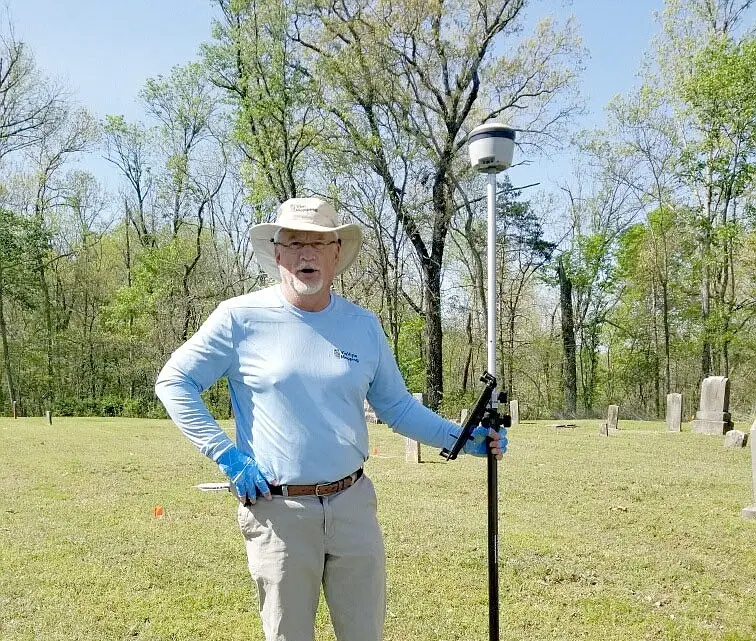
Ground Penetrating Radar (GPR) has become critical for locating unmarked graves and preserving the integrity of burial sites. This non-invasive technology allows cemetery managers, historians, and communities to rediscover forgotten plots, verify burial locations, and protect sacred ground from unintentional disturbance. At ViaVista, we use ground penetrating radar to find unmarked graves and subsurface anomalies […]
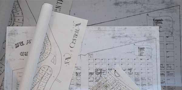
How to Create a Burial Plot Map
Create a Cemetery Plot Map With These Tips! A burial plot map is a must for managing a cemetery effectively. If you are responsible for managing a cemetery, then you know that mapping out the plots can be a daunting task. With so many graves to account for, it is important to use the best […]
Is Cemetery Ground Penetrating Radar Accurate?

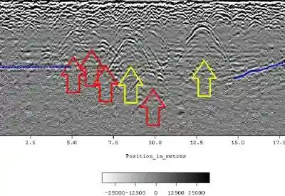
Cemetery ground-penetrating radar, or GPR, is a surveying technique that uses electromagnetic waves to detect and map the subsurface. It has been used for decades – but how accurate are these scans? The Accuracy of Ground Penetrating Radar (GPR) Technology Ground-Penetrating Radar is a highly accurate tool. Ground-penetrating radar can be impacted by external factors, […]
What is a Cemetery Plot Map?
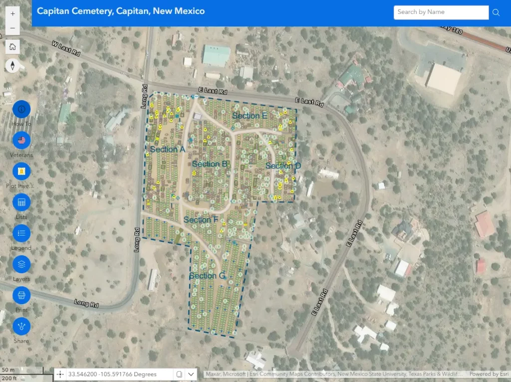
Cemetery burial plot maps are an integral part of any cemetery or crematorium and should provide an accurate location of every grave or cremated remains plot within the grounds and the spaces available. Maintaining an accurate cemetery map is essential for day-to-day operations, from ensuring that only available plots are sold to helping loved ones […]
Finding Unmarked Burials
Ground penetrating radar for cemeteries Cemeteries are home to a lot of history, with many US cemeteries having been around for hundreds of years. The passage of time affects each cemetery differently. Thanks to meticulous record-keeping and oversight, some historic cemeteries have pristine records. These cemeteries are, unfortunately, the exception and not the rule. The […]
Finding Unmarked Graves
Finding Unmarked Graves in the news from Wisconsin Public Radio. We talk with a UW-Eau Claire professor who uses deep ground penetrating radar to detect mass graves containing the remains of people who disappeared in clashes a half century ago. Featured in this Episode Finding Unmarked Graves from Wisconsin Public Radio Want to know more? […]
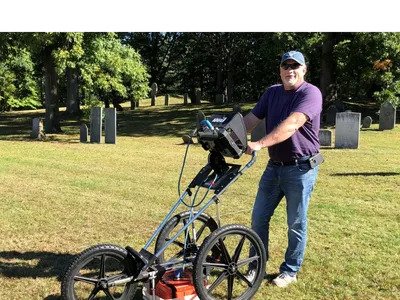
Cemetery GPR Scanning
Cemetery GPR Scanning? A Brief Guide! Cemetery GPR Scanning – what is it? GPR stands for Ground Penetrating Radar. This technology allows us to scan the ground to see what is hidden beneath the surface. It’s a non-invasive method of detecting objects buried deep in soil, sand, or gravel. Archaeologists and other scientists use cemetery […]
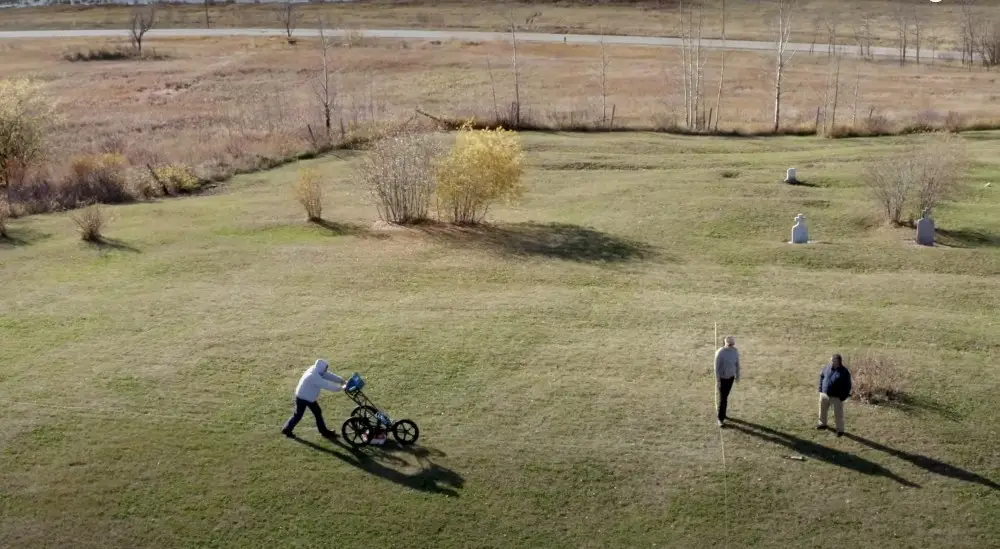
Finding Unmarked Graves at Cemetery
Finding unmarked graves in the news as reported by The McDonald County Press. Joyce Haynes of the Shelt Noel Cemetery Board said 46 unmarked graves were recently discovered at the cemetery. The board hired Scott Field of Via Vista Mapping, a GIS web map specialist, to bring ground-penetrating radar to search for unmarked graves. Haynes […]
CEMETERY MAPPING TO PRESERVE YOUR CEMETERY
There are many challenges that come with effectively operating a cemetery due to a lack of cemetery mapping: INCOMPLETE, INACCURATE, AND CONFUSING DOCUMENTATION In many communities, cemetery data is documented in spreadsheets, handwritten and typed books, coffee-stained maps, and even only known by one individual. Managing a cemetery with this kind of disjointed data can […]
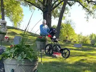
Cemetery Mapping News – Brandon South Dakota
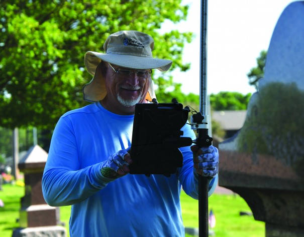
Cemetery mapping news: If you’re driving past the Brandon Lutheran Cemetery this week, you might see a strange man with strange equipment walking the grounds in the blazing heat. This man is Scott Field, owner of ViaVista Mapping, who is digitally mapping all of the marked and unmarked graves at the Brandon cemetery located along […]