
Digital Cemetery Mapping in Ritzville, WA
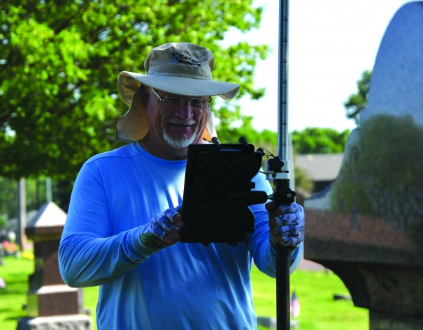
From the Ritzville Adams County Journal Digital cemetery mapping by ViaVista Mapping will begin in June starting with collecting field data and finishing with generating digital cemetery maps for the Ritzville Memorial Cemetery. According to a service agreement with the city, digital cemetery mapping services will include scanning for sub-surface anomalies and unmarked burials using cemetery ground […]
Digital Cemetery Mapping is Reshaping Cemetery Management

Digital cemetery mapping has reshaped the cemetery and death care services. In recent years, cemetery tourism or Tombstone Tourism, has seen a boom. The growing interest in genealogy has encouraged people to hunt out cemeteries in search of their ancestors. Finding ancestors’ burials is part of unearthing their family tree and stories. The fascination with […]
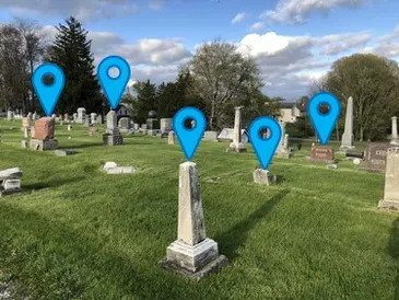
Finding Unmarked Burials

Ground penetrating radar for cemeteries Cemeteries are home to a lot of history, with many US cemeteries having been around for hundreds of years. The passage of time affects each cemetery differently. Thanks to meticulous record-keeping and oversight, some historic cemeteries have pristine records. These cemeteries are, unfortunately, the exception and not the rule. The […]
Cemetery Mapping Pricing

Cemetery Mapping – Understanding pricing Are you in charge of a private or public cemetery? Do you have missing or incorrect records that are causing major issues? Digital cemetery mapping services could be the answer you’re looking for. There are numerous affordable cemetery mapping options, using state-of-the art equipment and software, that will help manage […]
Burial Plot Map – Why is it Important?
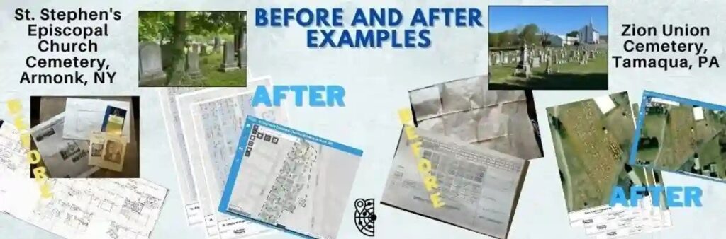
Burial plot map is a vital tool for cemetery caretakers. Many cemetery management offices often have cemetery plot maps in their offices for their employees and visitors to use. However, these maps are usually inexact and allow for too much variation to have a truly accurate understanding of the land available for future plots as […]
Cemetery Mapping Problems
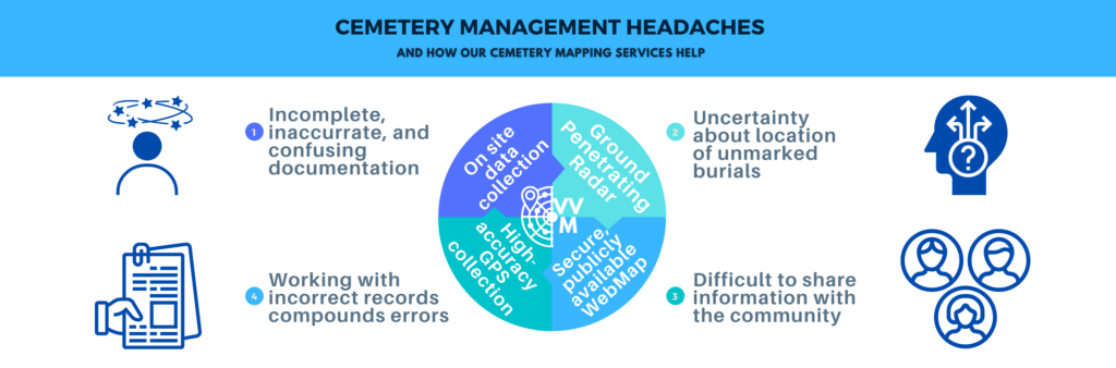
Cemetery Mapping Problems & Solutions Cemetery mapping can help address the most common problems for cemetery managers. Is your cemetery struggling with one of these common mapping issues? We’ve got you covered. Relying on aging paper maps Cemeteries are historic institutions. Their paper maps? Important historical documents. As with any aging documents, cemetery maps must […]
National Wreaths Across America Day

National Wreaths Across America Day is on Saturday, Dec. 16, and will take place at more than 4,200 participating locations across the country. This number of locations, which includes Arlington National Cemetery, is more than 500 above last year’s total. Wreaths Across America anticipates that more than 3 million volunteers—a third of whom are children—will participate […]
Finding Unmarked Graves

Finding Unmarked Graves in the news from Wisconsin Public Radio. We talk with a UW-Eau Claire professor who uses deep ground penetrating radar to detect mass graves containing the remains of people who disappeared in clashes a half century ago. Featured in this Episode Finding Unmarked Graves from Wisconsin Public Radio Want to know more? […]
Digital Cemetery Mapping enables Cemetery Tourism

Digital cemetery mapping is a key element for enabling cemetery tourism. Today, cemetery tourism is a growing market as traveler’s trek to graveyards around the world to reflect on their lives, seek out the grave of a famous person, or travel to learn more about their family by finding the final resting place of loved […]
GIS Cemetery Mapping Improves Cemetery Sales & Operations
GIS cemetery mapping provides cemetery managers with a highly effective tool to streamline their cemetery operations and also facilitates pre-need sales. Modern cemeteries strive to be present on various platforms and reach potential customers through different channels. It is for this reason they combine marketing and social media efforts with GIS cemetery mapping services. But […]